Saamia Makharia delves into the duality of language in British cartography and illustrates how her project challenges the speculative logic underlying Mumbai's development. By destabilizing established cartographic lines and associated land-sea binaries, she aims to recondition the surface to open up radical new possibilities.
FEDERICA ZAMBELETTI / KOOZ Muddy Waters: Deconstructing Mumbai's Coastline explores the colonial transformation of Mumbai's coastline, emphasizing the ongoing terrestrial colonization of nature. What prompted the project and what questions does it raise?
SAAMIA MAKHARIA Seventy percent of Mumbai is reclaimed land, and for decades, I have lived on a fraction of this manufactured terrain. The project emerges from the recognition that Mumbai’s coastline has been shaped by an ongoing process of colonization — not only through military occupation but through the continued terrestrial expropriation of land from the sea. The British conquest of Mumbai was not just one of territory but of perception, reinforcing a binary reality in which land is seen as stable, ownable, and productive, while water is framed as an entity to be fixed, enclosed, or erased.
At the core of this struggle lies the portrayal of how land should be settled, raising questions such as: has geography colonized the imagination to accept a surface? What is the relationship between water and power in taming Mumbai’s edges? Can water be seen as a contested entity through which modes of subjugation take place?
Nearly every account of Mumbai begins with the "geographical injustice" of it once being a cluster of seven islands. This narrative frames the city’s densification as a triumph over adversity — a story of conquering a disobedient landscape and taming its unruly waters through visionary interventions.
The project emerges from the recognition that Mumbai’s coastline has been shaped by an ongoing process of colonization — not only through military occupation but through the continued terrestrial expropriation of land from the sea.
However, as a situated spatial practitioner, my lived experience makes it difficult to accept these prevailing narratives, which often conform to standard historical scripts. Waterways, vital to the rise of civilizations, are deceptively anthropogenic. Controlling these spaces has long been tied to power, sparking conflicts over their domination.
Mumbai — a city shaped by and built upon water — has always been central to my understanding of space. Growing up here, I have witnessed firsthand how colonial strategies of enclosure, once used to claim land and impose binaries between land and sea, continue to shape the city’s development. Today, such practices manifest in two ways: first, through efforts to keep water out, for trade and infrastructure; and second, enclosing water itself — bringing water in, albeit for controlled uses and purposes.
From country clubs to coastal roads, the project explores how such methodologies persist in modern governance perpetuating social inequalities. How, then, does it serve as a tool of territorialization, to appropriate land and sea echoing colonial powers’ strategies to claim space?
KOOZ The project is principally presented through a number of blue line drawings. How does the chosen method of representation inform the reading of the proposal? In what ways is the medium the message?
SM The blue line drawings of the Private Members Club are intentionally sanitized, reflecting the idealized, controlled enclave it represents. They highlight the sanitization and exclusion embedded in the Club’s history, particularly the privatization of coastal access for a select few.
In the axonometric drawings, the style remains consistent, but the tone shifts from clinical, static representations to dynamic scenes. Unlike a map with fixed order, these drawings introduce life — people walking, floating, and interacting — positioning individuals as agents of change and signalling a shift from passive spaces to transformative landscapes.
While colonial maps sought to assert control over land, I use the same cartographic language to destabilize these notions. The process of fading — the gradual removal of "mud" in high-water areas of British maps— becomes a key technique in my work. Fading challenges the idea of fixed states, showing that land, water, and boundaries are not absolute. Similarly, in the proposal's plan drawings, the line and the mud are not static. The line is destabilized by making it serial and animated, illustrating how the accumulation of time shows a process. This serial production of landscape transformation destabilizes the line, shifting from rigid boundaries to a more fluid, evolving understanding. The proposal also shifts from lines to dots, blurring the edges and challenging fixed territorial definitions.
Just as colonial maps represented ambivalences, my drawings embody these tensions. They remain maps, but maps to be undone. I’m not changing the rules but offering a guided tour of unlearning and relearning the territory as imposed by the British. The drawings become a tool for deconstructing and reimagining territorial boundaries.
British colonial cartographies were not passive tools of representation but active instruments of transformation — redefining Mumbai’s coastline to serve a land-centric vision of urban expansion.

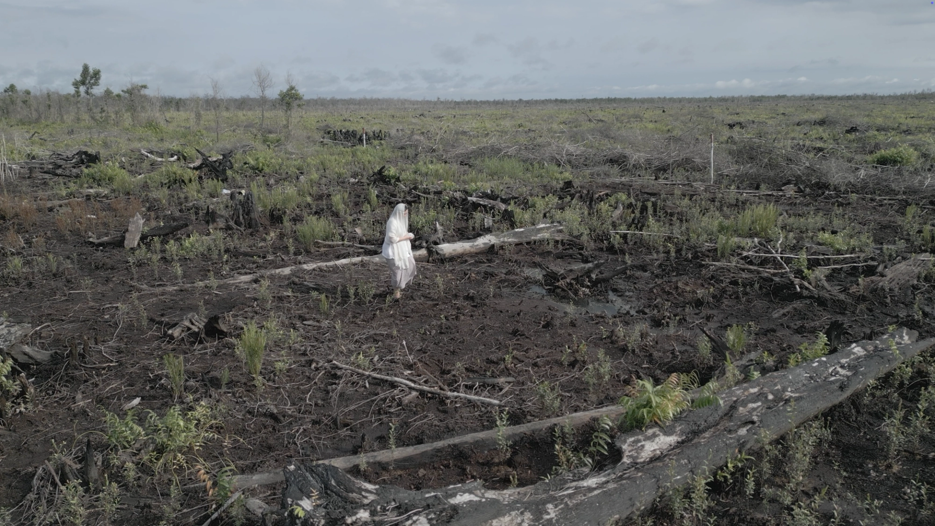
An ode to Mumbai as an archipelago. Credits Saamia Makharia.
KOOZ Specifically, the project looks into the duality of language presented through British cartographies of the landscape. What narratives unfoldthrough this analysis? What have been the repercussions of this colonial mapping?
SM The project reveals how British colonial cartographies were not passive tools of representation but active instruments of transformation — redefining Mumbai’s coastline to serve a land-centric vision of urban expansion.
This transformation was predicated on a systematic misreading of Mumbai’s estuarine ecology. The city’s intertidal zones — spaces alternately submerged during high tide and exposed during low tide — were manipulated to create reclaimed land. An 1865 map of Mumbai illustrates this, concealing the complexity of wetness by hatching shallow waters to appear as dry land. Yet, as the key reveals, they were actually mudflats covered at high water — both land and sea simultaneously. By flattening this duality into a singular cartographic line, the British constructed the very ground upon which the city expanded, legitimizing reclamation as conquest.
Despite efforts to create fixity, landscapes persist beyond the surveyor’s delineation. Mumbai’s Kolis, artisanal fishermen inhabiting muddy waters for centuries, exemplify this interterritorial usage, punctuating intertidals for fishing commons. From fish drying and boat repair to how their fishing stakes are used at sea, there is a temporality in the way they work with the rhythms of water. Similarly, Mumbai’s mangroves defy root-shoot, land-sea divisions, sometimes visible, sometimes submerged, always concordant with the tides. Such practices dissect the coastline, bypassing the government's attempts to enforce permanent divisions between wet and dry, land and sea, and communal and private.
Despite these efforts, colonial-era territorial fictions continue to be sustained. The coastal road project, for example, reclaims 90 hectares along Mumbai’s intertidals, further erasing the Kolis' commons and historical claims. Even the Coastal Regulation Zone’s 500-meter buffer has proven symbolic, redefining safeguarded intertidals to multiply development potential. The city perpetuates its “colonization” of the sea, masking extant occupations to tell a grand narrative of infrastructure — aqua nullius. By exposing these erasures, the project challenges the constructed nature of Mumbai’s coastline, reclaiming space for narratives that were deliberately obscured in the making of the colonial city.
KOOZ The project proposes a series of counter-strategies. How are these conceived to interact with the landscape? Through what time scales do such strategies operate?
SMIn favor of agencies alienated by colonial dualities that still dictate land expropriation, the project proposes counter-strategies offering entry into an alternate ground — one that is dynamic, aqueous, and constructed in time instead of static geography. The surface is reconfigured to allow communal reclamation by Mumbai’s indigenous fishers and ecologies at the center of such histories. Located adjacent to colonial forts, once vigilant points securing the edge of the island but now consumed by landfill and infrastructure, the project recognizes their significance as former coastal landmarks. Learning from enclosed pools and their inherent power, a series of similar enclosures are proposed adjacent to these landmarks — areas inherently muddy in nature.
The first enclosure is at Sion Fort, transformed from a bustling mill area into a “world-class” residential hub. Despite this gentrification, disused warehouses persist, with the new enclosure replacing one. Contrasting with stable, static, gridded enclosures, it is fluid and adaptable, linked to fluctuating tides. While functioning as a temple tank during certain tidal phases, its earthen boundaries interrupt processes of privatization, gradually yielding to nature. Platformed rings contain water spillover — rising at high tide, retreating at low tide, eroding edges, and triggering a controlled collapse. Eventually, muddy water clears the site, paving the way for new occupations.
Flooding inevitably becomes a tool for testing land-sea relationships, destabilizing the constructed language of dualities.
Similarly, at the Shiv Fort, a bus depot has been transformed into a tidal park, integrating recreational facilities, mangrove rehabilitation, and a creek-side lido. The enclosure, once again, is designed to yield to nature — working as a Trojan horse to bring the flow of water back to the coast. Flooding of the lido reconditions the ground — diffusing private edges, reconnecting the creek, and making solid lines muddy.
Waters brought inland plants the seeds of the former coast, reflecting a new yet old expression of the landscape, with the role of mud igniting the process of decolonization. Flooding inevitably becomes a tool for testing land-sea relationships, destabilizing the constructed language of dualities. By reconfiguring the territory over a 50-year span, the proposal challenges the logic of fixed urban development, constructing a new imaginary by which the urban performs.
Bio
Saamia Makharia is an award-winning architectural designer from Mumbai whose boundary pushing work critically examines the enduring and unexplored legacies of colonial power and their spatial manifestations. Her projects explore contemporary Indian identities in conjunction with British spatial practices, interrogating the socio-political implications of urban planning in shaping power dynamics, access, and belonging. Currently completing her master's at the Architectural Association, Saamia’s work has been widely recognised, for the RIBA Bronze Medal, Architects’ Journal Prize, and the Maison/0 Green Trail, alongside winning the Spatial Practices Award at Central Saint Martins. Her research spans alternative models of domesticity, infrastructure inequality, and territorial reclamation, challenging entrenched narratives of urban development.
Federica Zambeletti is the founder and managing director of KoozArch. She is an architect, researcher and digital curator whose interests lie at the intersection between art, architecture and regenerative practices. In 2015 Federica founded KoozArch with the ambition of creating a space where to research, explore and discuss architecture beyond the limits of its built form. Prior to dedicating her full attention to KoozArch, Federica collaborated with the architecture studio and non-profit agency for change UNA/UNLESS working on numerous cultural projects and the research of "Antarctic Resolution". Federica is an Architectural Association School of Architecture in London alumni.